
After five years of research, this week the San Francisco Planning Commission will get its first look at the seven strategies that could redefine the city’s shoreline in the decades ahead.
The Port of San Francisco, in partnership with the Army Corps of Engineers and other San Francisco city agencies, has developed seven Draft Waterfront Adaptation Strategies to deal with rising sea levels caused by climate change. They range from a “managed retreat” of buildings and critical systems out of harm’s way to raising shorelines from Mission Bay to the Embarcadero.
The presentation from Planning Commission staff connected to the Waterfront Resilience Program is informational and one of many over the coming months soliciting feedback about the big-picture plans, with a goal of choosing a strategy or combination of several by next summer. Part of what the city needs to decide over the next few months is just how much climate change may impact the waterfront, with plans addressing everything from 1.5 to 7 feet of sea level rise by 2090. Some of the plans, but not all, also take on the seismic issues associated with the Embarcadero, upgrades that an earlier report from the Resilience Program priced at about $2.5 billion.
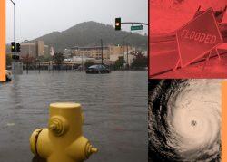
That report also showed that doing nothing would be even more costly: up to $30 billion in present-value damages by 2100. With no action, the resilience program says in its latest report that its coastal modeling “shows the potential for significant and unacceptable flood damages beginning as early as 2030.” While there are already projects like Mission Rock that have flood risk mitigation built into their plans, “these are targeted efforts that address a very small portion of a much larger problem.”
“Taking no action would not reduce the risk of coastal flooding that could begin to cause economic damages and interruptions to private property and public assets and impact transportation corridors, the performance of wastewater and stormwater systems and the stability of the electrical grid,” the new report reads.
Some strategies allow for the city to flood periodically, but minimize the damage that flooding would cause through a combination of warning systems, raising buildings and buying out property owners to move buildings away from rising waters. Inland areas would likely need to allow increased housing density and mixed-use zoning to allow residents and businesses to stay in the city while pulling back from the waterfront.
The problem could also be solved mechanically, through the use of pumps and engineered lagoons along the Embarcadero, in the Bayview and Mission Bay, as well as raising the shoreline and bridges at Islais Creek and Mission Creek. Another strategy involves creating “tide gates” at those creeks, which can be closed to reduce flood risk during increasingly frequent storms or high tides and would mean that roads, bridges and shoreline edges would not need to be raised.
The most transformative option would be to restore historical natural watersheds at the creeks, essentially restoring them to a pre-industrial state. Port operations in the Bayview would need to move inland, and a combination of buyouts, rezoning and land grants would lead industrial property owners to “gradually vacate” the area. The Embarcadero would need to be narrowed and reconfigured and the shoreline and Ferry Building raised. Under this plan, by 2090 Mission Bay would become “a floodable district, with significant changes to all urban systems.”
Read more

Commercial
San Francisco
SF's Embarcadero needs up to $2.5B to keep it safe from major quake
Commercial
San Francisco
SF “bomb cyclone” may be foretaste of storms driving up housing, insurance costs