
Paramount may soon pave the way for 5,000 more homes.
The once-blighted suburb in southeast Los Angeles County has proposed rezoning 279 acres along a forthcoming light rail line for more homes, Urbanize Los Angeles reported.
The West Santa Ana Branch line, slated to open in two decades, will run 19 miles between Artesia and Downtown Los Angeles, with two stations within the city of 54,000 residents north of Long Beach.
The city plans to make the best of those stops by increasing home density limits between an area bordered by Rosecrans Avenue to the south, Century Boulevard and Howe Street to the north, Anderson Street to the east, and the rail right-of-way to the west.
Its proposed North Paramount Gateway Specific Plan would meld two current plans — the Clearwater North Specific Plan and the Howe/Orizaba Specific Plan — in place since 1987.
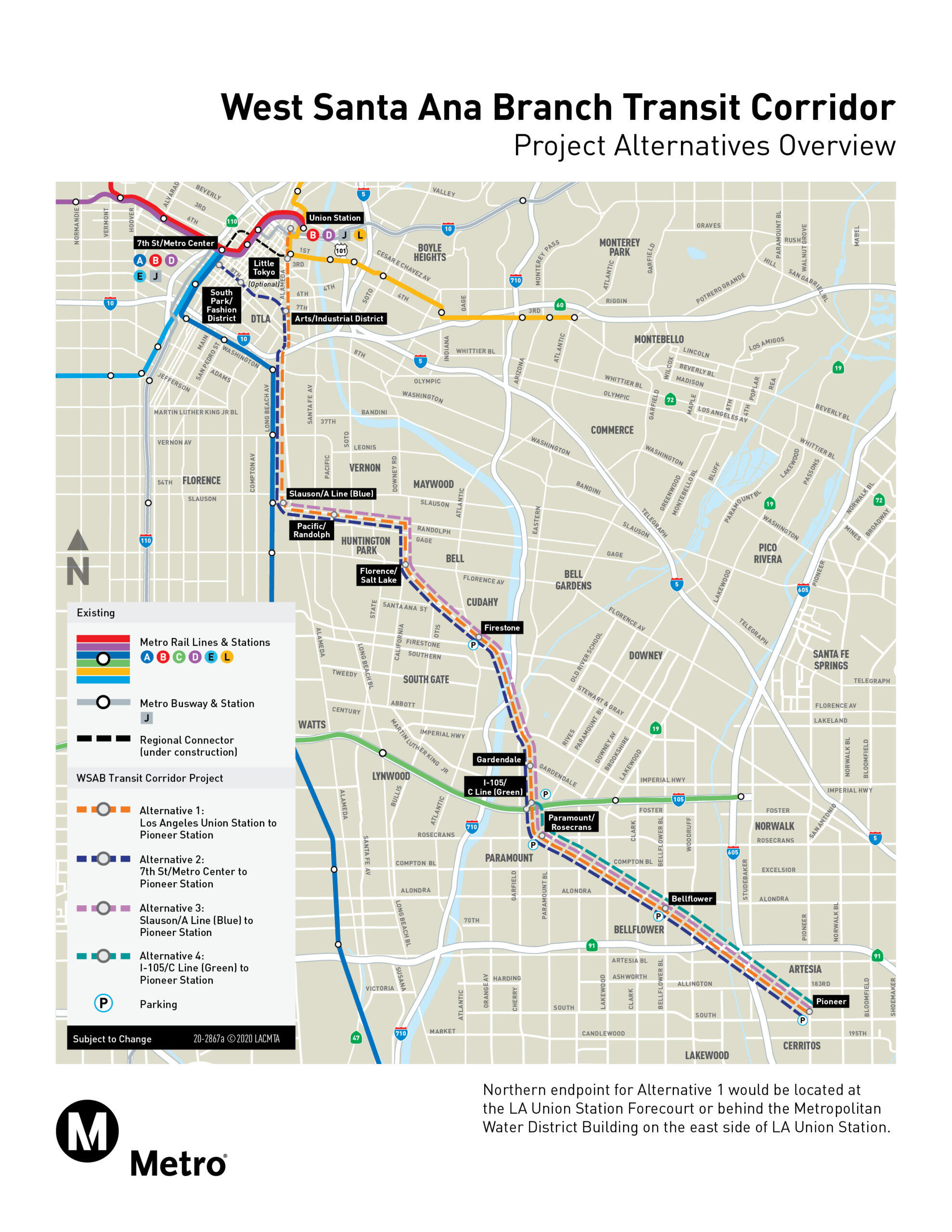
Map of future West Santa Ana Branch Corridor (Metro)
The new plan would boost maximum housing density from a current limit of 22 units per acre to 40 units per acre along Paramount Boulevard and Rosecrans Avenue, and up to 30 units per acre on side streets.
Allowable building heights would range from 30 to 45 feet, with maximum floor area rights (a ratio of the building area divided by the lot area) set between 1.5 and 2.0, according to Urbanize.
Besides revised zoning rules, the specific plan proposes public improvements around the new rail stations, including wider sidewalks along Rosecrans Avenue and Paramount Boulevard. It would also include curb extensions at major intersections, new pedestrian crossings and signs, bike lanes on Paramount, and lanes and signals that give priority to buses.
The new specific plan, which is undergoing an environmental review, will require adoption by the Paramount City Council. If approved, it would allow construction of 5,000 homes and 31,000 square feet of shops, restaurants and offices.
Paramount, a former dairy and hay hub, became so decayed it was labeled an “urban disaster area” four decades ago. The city then launched an urban renewal campaign that transformed it into an All-American City, according to its website.
It’s also the latest city in southeast L.A. County looking to benefit from the $3.5 billion West Santa Ana Branch line.
Nearby South Gate is creating a transit-oriented district around its future Metro train station that could allow 500 more homes and 230,000 square feet of offices, industrial buildings and shops and restaurants.
The growing rail lines south of Los Angeles are leading to new development, as well as gentrification of historic Black and Latino neighborhoods, according to critics. Metro aims to bank land near future rail stations to sell to affordable housing developers to thwart such gentrification.
— Dana Bartholomew
Read more

Development
Los Angeles
Crenshaw/LAX rail line draws development to South LA

Residential
Los Angeles
Transit agency to bank land near future rail stations to stymie gentrification